BYRON'S GAMES

  • Start Here
  • Meet Byron
  • Get the Game
  • Have Fun
  • Blog
  • Explore More
  • Store
  • Get the App!
  • Join our Community
  • Start Here
  • Meet Byron
  • Get the Game
  • Have Fun
  • Blog
  • Explore More
  • Store
  • Get the App!
  • Join our Community

2020 Olympics in 2021

7/26/2021

1 Comment

 
Olympic Rings and Flag of Japan
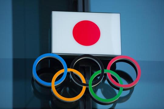
Olympic rings and flag of Japan.
After dealing with a worldwide pandemic and postponing the Summer Olympics of 2020, we were finally able to watch the Opening Ceremony hosted in Japan on Friday, July 23, 2021.

The Olympics have held a very special place in our family's heart - especially Byron. He was hospitalized in 2016 during the Summer 
Olympics in Rio de Janeiro, Brazil. Byron created the game Continent Race at age 6, during a month-long stay at Ann and Robert H. Lurie Children's Hospital in Chicago. Byron enjoyed helping Mrs. Ellen Donovan, of the Family Life Center, keep track of country medal counts during the 2016 Summer Olympic Games. Once the games ended, "Ms. Ellen" challenged Byron to create a game using flags. Byron took the challenge and ran with it! When he began creating the game, he immediately decided he wanted to create it for children in the hospital, so that they could play something fun AND learn while they recovered.

Byron started out helping keep track of medals won and identifying world flags. That lead to matching the flags to a map of the world, which quickly developed into our game Continent Race! You can keep track of medals won in this year's Olympics by clicking here.

We also have a fantastic Olympics sale going on over at Amazon. Right now, the game is 12% off, but you can save an additional 11% through the end of the Olympics now through August 8th by clicking on the coupon in Amazon. That's a total of 23% savings! This also includes Prime One-Day shipping, so your family can use the game to create your own Olympics medal chart at home before the closing ceremony.

We hope you all enjoy the Olympics as a family and may we all watch athletes around the world strive for greatness with the new motto, "Faster, Higher, Stronger - Together."

1 Comment

February 26th, 2020

2/26/2020

0 Comments

 
Picture
Laguna Colorada (Red Lagoon) is a shallow salt lake in the southwest of the altiplano of Bolivia, within Eduardo Avaroa Andean Fauna National Reserve and close to the border with Chile.

The lake contains borax islands, whose white color contrasts with the reddish color of its waters, which is caused by red sediments and pigmentation of some algae.

Flamingos are drawn to the lake thanks to its abundant supply of plankton. Three of the world’s six species of flamingo can be found here: the Chilean, Andean and the James’ Flamingo. That last one is incredibly rare – the species is only found in the high Andean plateaus and was thought to be extinct until a small population was rediscovered in 1956. Curiously, the flamingos are naturally white; they look pink because the red algae stains their feathers.
0 Comments

Where In The World Wednesday: Denali National Park

2/19/2020

0 Comments

 
Picture
Denali National Park and Preserve is an American national park and preserve located in Interior Alaska, centered on Denali, the highest mountain in North America. The park and contiguous preserve encompass 6,045,153 acres (9,446 sq mi; 24,464 km2) which is larger than the state of New Hampshire. On December 2, 1980, 2,146,580-acre (3,354 sq mi; 8,687 km2) Denali Wilderness was established within the park. Denali's landscape is a mix of forest at the lowest elevations, including deciduous taiga, with tundra at middle elevations, and glaciers, snow, and bare rock at the highest elevations. The longest glacier is the Kahiltna Glacier. Wintertime activities include dog sledding, cross-country skiing, and snowmobiling.
​
Denali is home to a variety of North American birds and mammals, including an estimated 300-350 grizzly bears on the north side of the Alaska Range (70 bears per 1000 square miles) and an estimated 2,700 black bears (334 per 1,000 square miles). As of 2014, park biologists were monitoring about 51 wolves in 13 packs (7.4 wolves per 1,000 square miles), while surveys estimated 2,230 caribou in 2013, and 1,477 moose in 2011. Dall sheep are often seen on mountainsides. Smaller animals such as coyotes, hoary marmots, shrews, Arctic ground squirrels, beavers, pikas, and snowshoe hares are seen in abundance. Red foxes, martens, lynxes, wolverines also inhabit the park, but are more rarely seen due to their elusive natures.

Many migratory bird species reside in the park during late spring and summer. There are waxwings, Arctic warblers, pine grosbeaks, and wheatears, as well as ptarmigan and the majestic tundra swan. Raptors include a variety of hawks, a variety of owls, and gyrfalcons, as well as the abundant but striking golden eagles.
0 Comments

Where In The World Wednesday: Boracay, Philippines

2/12/2020

0 Comments

 
Picture
Boracay is a small island in the Philippines, 7 km long and 1 km wide, located in the Western Visayas approximately 315 kilometers (196 miles) south of Manila and 2 kilometers (1.2 mi) off the northwest tip of Panay Island. Boracay has a population of 32,267 as of February 2016.

The island comprises the barangays of Manoc-Manoc, Balabag, and Yapak in the municipality of Malay, in Aklan Province. The island is administered by the Boracay Inter-agency Task Force. Apart from its white-sand beaches, Boracay is also famous for being one of the world's top destinations for relaxation. As of 2013, it was emerging among the top destinations for tranquility and nightlife.

Boracay was awarded as the 2012 Best Island in the World by the international travel magazine Travel + Leisure. In 2014, the resort island was at the top of the "Best Islands in the World" list published by the international magazine Condé Nast Traveler. In 2016, Boracay headed the magazine's list of "Top 10 destinations to watch".

In April 2018, the Philippine Government decreed a 6-month closure of the island for tourists to undertake major renovation works, especially of the sewage system, which had become obsolete and insufficient. It re-opened in October 2018, with a set of new rules meant to address a variety of issues.


0 Comments

Where In The World Wednesday: Antarctica

2/5/2020

0 Comments

 
Picture
​Antarctica is Earth's southernmost continent. It contains the geographic South Pole and is situated in the Antarctic region of the Southern Hemisphere, almost entirely south of the Antarctic Circle, and is surrounded by the Southern Ocean. At 14,200,000 square kilometers (5,500,000 square miles), it is the fifth-largest continent and nearly twice the size of Australia. At 0.00008 people per square kilometer, it is by far the least densely populated continent. About 98% of Antarctica is covered by ice that averages 1.9 km (1.2 mi; 6,200 ft) in thickness,[5] which extends to all but the northernmost reaches of the Antarctic Peninsula.

Antarctica, on average, is the coldest, driest, and windiest continent, and has the highest average elevation of all the continents.[6] Most of Antarctica is a polar desert, with annual precipitation of 200 mm (7.9 in) along the coast and far less inland; there has been no rain there for almost 2 million years, yet 80% of the world freshwater reserves are stored there. The temperature in Antarctica has reached −89.2 °C (−128.6 °F) (or even −94.7 °C (−135.8 °F) as measured from space[8]), though the average for the third quarter (the coldest part of the year) is −63 °C (−81 °F). Anywhere from 1,000 to 5,000 people reside throughout the year at research stations scattered across the continent. Organisms native to Antarctica include many types of algae, bacteria, fungi, plants, protista, and certain animals, such as mites, nematodes, penguins, seals, and tardigrades. Vegetation, where it occurs, is tundra.
0 Comments

Flag Fact Friday: Isle of Man

1/31/2020

0 Comments

 
Picture
The flag of the Isle of Man or flag of Mann (Manx: brattagh Vannin) is a triskelion, composed of three armoured legs with golden spurs, upon a red background. It has been the official flag of Mann since 1 December 1932[2] and is based on the Manx coat of arms, which dates back to the 13th century. The three legs are known in Manx as ny tree cassyn ("the three legs"). The triskelion is an ancient symbol, used by the Mycenaeans and the Lycians. It is not known for certain why the symbol was originally adopted on the Isle of Man. Before its adoption in 1932, the official flag of the Isle of Man was the Union Jack.

There is also a civil ensign for the Isle of Man. This flag was first authorised on 27 August 1971. Another Manx flag is the flag of Tynwald, the legislature of the Isle of Man, which has flown outside the Legislative Buildings since 1971.

Local residents of the Isle of Man explain that the legs on the flag turn anti-clockwise so that they don't kneel to the British!
0 Comments

Where In The World Wednesday: The Namib Desert, Namibia

1/29/2020

0 Comments

 
Picture
The Namib is a coastal desert in southern Africa. The name Namib is of Khoekhoegowab origin and means "vast place". According to the broadest definition, the Namib stretches for more than 2,000 kilometers (1,200 mi) along the Atlantic coasts of Angola, Namibia, and South Africa, extending southward from the Carunjamba River in Angola, through Namibia and to the Olifants River in Western Cape, South Africa.[1][2][3] The Namib's northernmost portion, which extends 450 kilometers (280 mi) from the Angola-Namibia border, is known as Moçâmedes Desert, while its southern portion approaches the neighboring Kalahari Desert. From the Atlantic coast eastward, the Namib gradually ascends in elevation, reaching up to 200 kilometers (120 mi) inland to the foot of the Great Escarpment.

The Namib is almost completely uninhabited by humans except for several small settlements and indigenous pastoral groups, including the Ovahimba and Obatjimba Herero in the north, and the Topnaar Nama in the central region. Owing to its antiquity, the Namib may be home to more endemic species than any other desert in the world.[5] Most of the desert wildlife is arthropods and other small animals that live on little water, although larger animals inhabit the northern regions. Near the coast, the cold ocean water is rich in fishery resources and supports populations of brown fur seals and shorebirds, which serve as prey for the Skeleton Coast's lions.
0 Comments

Flag Fact Friday: Gibraltar

1/24/2020

0 Comments

 
Picture
The flag of Gibraltar is an elongated banner of arms based on the coat of arms of Gibraltar, granted by Royal Warrant from Queen Isabella I of Castile on 10 July 1502.

The flag was regularized in 1982 and is formed by two horizontal bands of white (top, double width) and red with a three-towered red castle in the center of the white band;[3] hanging from the castle gate is a gold key centered in the red band. The flag differs from that of other British overseas territories, in that it is not a British ensign nor does it feature the Union Jack in any form. The castle does not resemble any in Gibraltar but is supposed to represent the fortress of Gibraltar. The key is said to symbolize the fortress' significance as Gibraltar was seen to be the key to Spain by the Moors and Spanish and later as the key to the Mediterranean by the British.
0 Comments

Where In The World Wednesday: Pitons, St. Lucia

1/22/2020

0 Comments

 
Picture
The Pitons are two mountainous volcanic plugs, volcanic spires, located in Saint Lucia. Gros Piton is 798.25 m (2,618.9 ft) high, and Petit Piton is 743 m (2,438 ft) high; they are linked by the Piton Mitan ridge. The Pitons are a World Heritage Site, 2,909 ha (7,190 acres) in size, and located near the town of Soufrière.

The Pitons are located near the towns of Soufrière, Saint Lucia. Soufrière and Choiseul Quarter Choiseul on the southwestern coast of the island. They are in the electoral districts of three and ten. The Pitons are located on either side of the Jalousie Bay.

Coral reefs cover almost 60% of the site's marine area. A survey has revealed 168 species of finfish, 60 species of cnidaria, including corals, 8 mollusks, 14 sponges, 11 echinoderms, 15 arthropods and 8 annelid worms. The dominant terrestrial vegetation is tropical moist forest grading to subtropical wet forest, with small areas of dry forest and wet elfin woodland on the summits. At least 148 plant species have been recorded on Gros Piton, 97 on Petit Piton and the intervening ridge, among them eight rare tree species. The Gros Piton is home to some 27 bird species (five of them endemic), three indigenous rodents, one opossum, three bats, eight reptiles, and three amphibians.
0 Comments

Flag Fact Friday: Arab Republic of Egypt

1/17/2020

1 Comment

 
Picture
The flag of Egypt is a tricolor flag consisting of the three equal horizontal red, white, and black bands of the Egyptian revolutionary flag dating back to the 1952 Egyptian Revolution. The flag bears Egypt's national emblem, the Egyptian eagle of Saladin centered in the white band.

The Egyptian Free Officers who toppled King Farouk in the Revolution of 1952 assigned specific symbolism to each of the three bands of the revolutionary and liberation flag. The red band symbolizes the Egyptians’ blood in the war against colonization. The white band symbolizes the purity of the Egyptian’s heart. The black band below the white symbolizes the manner in which darkness is overcome.

Egypt's Revolutionary and Liberation flag was then an inspiration to several Arab countries and was adopted by many Arab states. The same horizontal tricolor is used by Iraq, Syria, Sudan, and Yemen (and formerly Libya), the only difference being the presence (or absence) of distinguishing national emblems in the white band.
1 Comment
<<Previous

    Categories

    All
    Events
    Family
    Flag Facts
    Golf
    Hero Highlight
    Math
    Music
    Virtual Learning
    Where In The World
    World Geography

Start Here
Meet Byron
Get the Game
Have Fun
Explore More
Store
Get the App!

Copyright © 2021 - Byron's Games